Showing posts with label Canada. Show all posts

Sunday, 4 August 2013

Return to Trail Pond

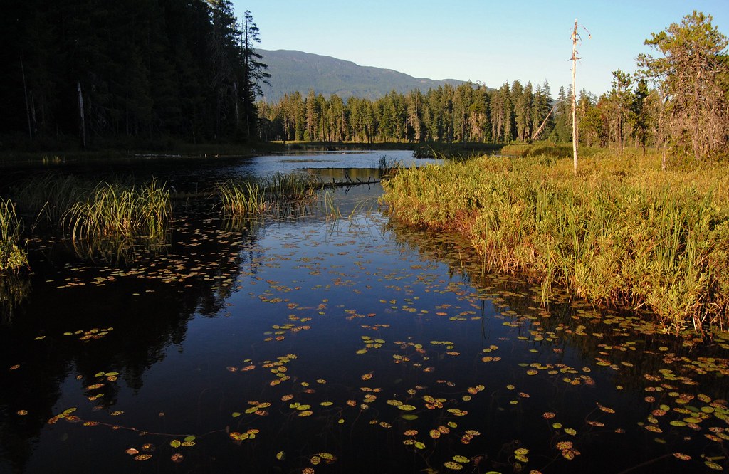
I just posted about an experience I had on Trail Pond in 2007. I decided to return to the lake on July 21st 2013 having found last year that the lake was sequestered behind a logging company gate. I bought a new canoe cart to assist in the effort, since the lake is about a kilometer inside the gate -- too far for me to comfortably carry my canoe.

New Canoe Cart
The walk in was uneventful, despite the huge number of bear turds freshly studded with road gravel, and the  eerie quiet that accompanies the heat of mid day.

The trail to the water's edge was completely grown over. Small firs had grown larger and one small tree had fallen across the trail. But once I negotiated my way through the bracken fern, raspberry, and salal, and climbed over the fallen tree, I found the shoreline and the old log where I used to put in when I first started visiting this lake in 2007.

These two shots are from slightly different angles, but you can see common markers in the snags and log. The water is higher by more than a foot and the young fir on the left was not even visible in 2007.

It took me a few minutes to collapse my cart and stow it in my canoe, and I confess I paused a moment to take in the pond in all it's summer glory. I don't think I have been on the pond at this time of year before and the verdant lushness was impressive.
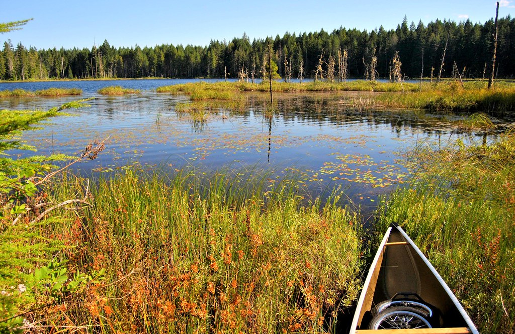

 After the dusty walk and effort to make my way through the underbrush, I was happy to get out on the pond where a nice breeze cooled me down, especially when I was across the lake and into the shade on the far side. I made the following video after exploring the shoreline for about an hour.


Here are a few of my favorite photos from this trip. For more, see my Trail Pond set on Flickr.


I was delighted to find I could paddle into areas of the wetland that had previously been blocked by sticks. Here is an image from 2007:


In 2013 I was able to paddle past this point right down to where the beavers had been busy.

Looking towards the beaver dam from the place I used to have to turn around.

The dam itself was impressive. I estimated a 4 or 5 foot drop on the downstream side.

A Healthy Beaver Dam

Looking downstream from the dam revealed a lush outflow, demonstrating the value of beavers in maintaining and improving wetlands.

Looking Downstream from the Beaver Dam
With my water bottle empty I decided to pack up and head home, stopping to enjoy one last look back before heading to Tim Hortons for an Ice Cappachino with an espresso shot!


A Note about logging and pretension. 

Readers of this blog have sometimes criticized me for being pretentious when I express my sadness over the ugliness logging creates beside treasures like Trail Pond. While I do mourn the loss of beauty often in my writing, I am careful to balance it with an appreciation of logging as a mainstay of the BC economy and I do value being able to use logging company and forestry roads to access these locations.

I have commented lately to family and friends that cuts are much less ugly than in years past. This is due in part to the practice of creating smaller cuts, spread out over the whole island, rather than large clear cuts as was the practice before. For example, only one hillside was logged here at Trail Pond and it is actually not ugly at all. The presence of a gate, which appears to be locked indefinitely, seems also to have kept the yahoos out. I didn't see any beer cans or other litter. No torn up ground, burned logs, discarded sleeping bags, or other evidence of human impact. It was, I have to say, a welcomed surprise. While visiting this place in the last few years I have met bicyclists, hikers, and one man riding an impressive and beautiful horse. It seems to me that all such uses place a very light load on the road and land; and the gate's strategic location has also kept ATVs out, which adds to the quiet and tranquility of the location. Now before all the ATVers start up, I'm not opposed to the responsible use of quads but have seen some ugly scars created by quads on hillsides and in forests. Worse that any skidder now in use!

I know I am uncomfortably sentimental for many when I write and talk about these beautiful places, but I am unapologetic. Beautiful natural settings and tranquility seem to be diminishing in our world. I see houses being built and "no trespassing" signs going up, where previously the wider public enjoyed the views and scenery. I love these places and want to see them respected and preserved so that future generations can have the same experiences we who now visit them have. I hope trail pond continues to be a haven for turtles, beavers, and the odd ducks like me.


Wednesday, 14 September 2011

Muriel Lake

Vancouver Backroads Map Book 4th Edition -- Map 14 A5
Atlas of Canada Link: Muriel Lake

Latitude/Longitude:
Degrees, Minutes, Seconds: 49° 7' 37" N 125° 37' 10" W
Decimal Degrees: 49.127° N 125.619° W
UTM Coordinates: 10U 308902 5444878
Topographic Map Sheet Number: 092F04

Trip Date: September 10, 2011

Muriel Lake

Getting to Muriel Lake takes two days. Not because it actually takes two days to drive there from Nanaimo, but because we were not heading to Muriel Lake at all -- we were heading to the recreational forestry camp site on Kennedy Lake, hoping to camp there and then paddle down the river to the Kennedy River Bog.

There are a half dozen shirtless and tattooed young men lazing about or wandering about a semi-permanent looking camp at the Kennedy Lake Rec site when we drive up. We changed our plans for where were will sleep the night.

The next morning we are back, but now the put-in by the Kennedy River bridge is blocked by a car with the hatch up and doors open. We walk down to have a look. A sleepy-sounding couple calls hello from a tent under the bridge, "Did you want to launch your boat? We can move our car," the fellow asks. The back of the car is strewn with underwear, food wrappers, and a tipped over foam cooler. "It's OK," I call back, "I think we are going somewhere else."

The Put-in at the Kennedy River Bridge from my scouting trip in 2008

I thought of the conservative American scholar James Q. Wilson's line, "“Arresting a single drunk or a single vagrant who has harmed no identifiable person seems unjust, and in a sense it is. But failing to do anything about a score of drunks or a hundred vagrants may destroy an entire community.”

There is a certain romance in a lone tramp rambling his way through the outskirts of town, or along a remote wilderness, using his wiles and wits to live free and unencumbered. There is also an icy prickle over the skin when you fall under the gaze of 12 shiftless eyes in decidedly shifty circumstances.

My dad used to say, "In the wilderness the most dangerous animals are usually human," and I have heeded this truism whenever my gut gives me pause.

We head to Muriel with some sense of disappointment and apprehension.

When I visited Muriel lake in 2008 the drive was reasonably pleasant and the put-in looked like this:


I am surprised to see how much the road beyond the Kennedy River Bridge has deteriorated in 3 years. Large rocks now protrude from the hard packed road bed and in places the Pacific Ninebark, Thimble Berry and Salmon Berry, and various other bushes, crowd close at the edges. There is a sense that the road could disappear into the forest from lack of use. One spot in the road has recently been filled with soil, the efforts most likely of whomever frequents the two cabins located on the lake. The road down to the lake is definitely best attempted with 4 wheel drive, but the concern is really getting up afterwards as there are some large exposed rock where rain has washed the gravel away.

View from the Put in -- 2011

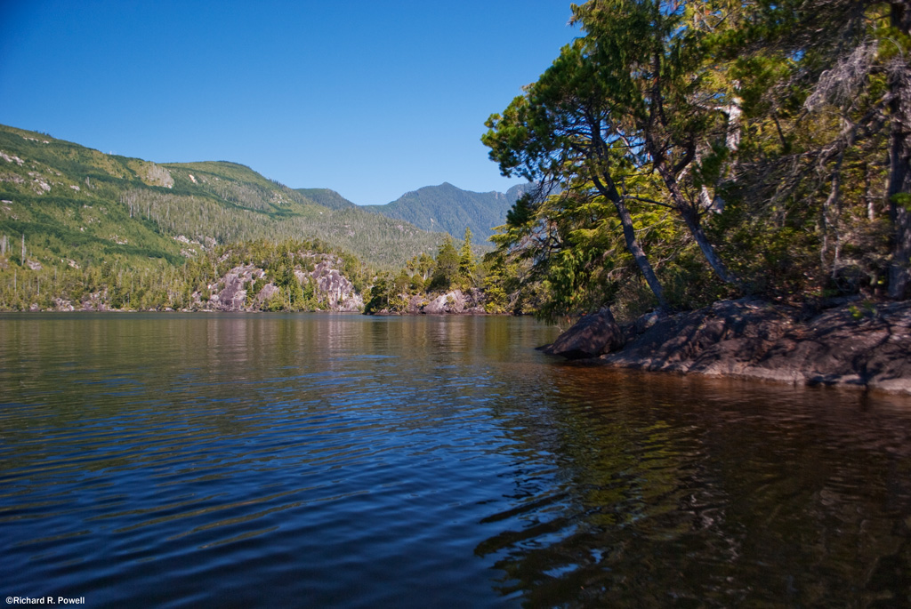
We put our canoes in the water and paddle towards the south eastern corner of the lake, between the two islands visible from the put-in and into a bay filled with water shield.


Paul points out several twisted logs resting on rocks and along the shoreline, their curves and patterns exposed and white under the sun.


These two features, weathered wood and exposed rock, are prevalent themes for the lake. The multiple rocky peninsulas are pleasing combinations of stone and contorted pines. The trees show character in the face of what must be hard winters of torrential downpours and heavy snow.


The heat from the sun is intense so we hug the shady shore, enjoying the rugged beauty of each meter of shoreline.


About 1/4 of the way down the lake we pass  a steeply sloped cluster of small rocky islands with one pine doing apparently well amid what seems like very sparse soil conditions. I can't help thinking of my favorite Lone Tree Island on Goose Lake.


We glide over shallow areas where we can see long stretches of rock slanting gradually into the depths, or ending at dark precipices.


On the Northern shore dark green bands of growth show the roads and gullies and I'm thankful that for the moment there are no new clearcuts to distract from the pleasing patchwork of new growth and older forest.


After Paddling for about an hour we get out to stretch our legs on a wide stony shelf a foot below the surface of the water. The cool of the water and the shade from the tall trees give us a chance to contemplate the beauty of the place. We watch schools of small fish moving in and out of the shadows and hear what sounds like a frog plop into the water somewhere down the shore.


When we climb back in our canoes we continue down the lake moving in and out of bays and stopping from time to time to admire large cedar trees. Several handsome specimens of Yellow Cedar stand out amid the more numerous Red Cedar.


Nearing the western end of the lake we disturb a pair of osprey who fly from their nest and seem to lure us away, calling and flying and landing in trees and flying again. We follow them for a ways enjoying their uncommon beauty before turning north and then east to head back into the wind along the northern shore.


The largest island on the lake has some impressive cliffs, but from this side we have trouble seeing where the passage is between it and the northern shore. We paddle hard into the wind and then finally find it, slipping through to find a small archipelago of islands behind it with a houseboat/cabin moored in the protected waters between them.


It strikes me as a perfect spot to tie up, but we don't go ashore, not knowing if this is private property or not. Paul notices Christmas lights on the outside and we can imagine spending a cool evening around the pot bellied stove inside with water lapping at the weathered wood outside.


Then it is back into the teeth of a steady wind, powering our way back to the put-in. We get out, boil water for hot dogs and tea, and while away the afternoon eating, putting away our gear, and enjoying a most pleasant spot.

Back at the Put-in

Saturday, 20 November 2010

The Secret Lake the Faller Showed Me

Logged Area Surrounding Black Lake
I have known a few fallers.  As a boy, a timber faller, his dented orange hard hat and red checked jacket, talked to my father at the truck window about the way the earth thumps when the big trunks land. They were big trunks in those days. I watched the man step off the road, over logs, up the bank. His friendly wave before picking up his saw.  The tattered ends of his jeans lifting and dropping on his high shafted boots as he stepped over debris and slash. Dad started the truck, and we headed on to the fishing hole.  I turned in my seat to watch one of the trees at the edge of the cut fall down hill. The springiness of it as it landed.

A faller, his nostrils full of wood dust and the smell of chain oil, feels the power of internal combustion attached to a flying chain of blades, the challenge and exhilaration of dropping large pillars of carbon, tons of wood - the neck stretching openness in the canopy for the blue sky  to step around in fractals between the remaining treetops.

Plug for the gender mold. The archetypal-larger-than-life-macho-logger.  Steel toed boots, the heavy fabric of faller chaps stained with oil, the saw jamming fabric shirt brown with sweat and dirt, the constant current of danger like an eel in a river, the constant numbness in the arms from vibration, the finger tips buzzing.


After the saw is snuffed into silence, after the foam removed from ears, after the sky begins sucking away as much heat as the sun brings in, now low to the horizon - then he stops and ponders the beauty of the place, the funny way the cut opens the forest like an ancient story opens a deepness in the soul. The sweet smell of cut logs mixed with the minty crackle of gum. Good to end a day alive, and then go for a beer with the others in the warm loud span of laughter and forgetting.

A Fire Warden I met on a dusty logging road this summer on the hottest day of the year showed me a lake I could paddle on. His lake. One of his secret spots. He found it years ago when he was a faller. We sat in our vehicles, window to window talking about the changes in the forests - small contractors, more fatalities, a changing way of life. Companies from China securing fibre rights, converting mills to specialty products. And then, he said, he was married to a woman who was Chinese.


The walk to the lake was worth it, he told me, because he had saved a swath of old growth trees. The hillsides around the lake were covered in uniform carpet of new growth as I looked around after easing the canoe into the water from my shoulder.


The same familiar shortness of young trees. But along the edge of the water on one half of the lake a fringe of large trees. The faller's gift. He had asked the timber boss if they could be saved. The saws were already wining their way down the hill overlooking the lake, the trucks hauling away the big cellulose tubes. The boss said no, then a few days later, called back, "OK," he said, "The rest won't be cut." Sort of a miracle.


I paddled and admired the stand of old growth. At the south end of the lake, I tied the boat and walked in the shallow water.


The air was hazy with smoke from distant forest fires. The wind had been blowing earlier but had dropped. The shade of the massive trees seemed to provide an oasis from the heat and smoke.  The pattern of wave splash along the rocks.


They are rugged. They curse and spit and compete and joke. The rough company of men.  The guys who gave me a ride when I locked my keys in my Tracker a few years ago looked at me reluctantly from their Silverado LT 4X4. Working hard not to call me an idiot to my face. In the woods, regardless of how stupid someone is, you help him out.


Almost all the lakes I wish were protected, I accessed from the edge of a logging road. The patchwork quilt of cuts visible from space, and me disappearing like the speckles on a trout's back after you let it go.

on the hillside
a logger steps from log to log
hot saw swinging

Thursday, 7 October 2010

McNair Lake

Trip Date: October 3, 2010

As I gingerly ease the Tracker in and out of the large holes that crater the road leading away from McNair Lake, the springs in the seat creak and we sway this way and that. My passenger (contented and glowing from sucking in great drafts of beauty) leans over conspiratorially and says  "You won't blog about this place, right?"

I've heard this appeal before. The concern seems to be that if I show people what a special place it is they will all flock to it and trample the beauty into mud and gravel and then throw beer cans and old tarps in the water. We have seen this in too many other places already.
Lunch At McNair
The trouble is, that if the yahoos don't be-spoil it the forest companies probably will. The trees around McNair are getting big enough to harvest. Before long the saws will start to whine and the hillsides will lose their beautiful blanket of undulating fir to be replaced by a patchwork of logging cuts. Beauty is not nearly as valuable as logs and fiber.

I'm not against logging. I'm not a tree spiker or tree hugger. But I have to confess I feel pretty sad to think that this area will soon look like a half plucked chicken.

The Sayward forest should, in my humble opinion, be protected because of it's beauty. But my opinion isn't likely to have much effect on changing the fate of this place. Still, I do what I can. And part of what I can do is post some photos and at least let posterity see what a beautiful place this was before the loggers had their way with it.


Because of course once the saws get busy it will be a hundred years or more before it will look like this again. I'll be long gone by then. I wonder if my photos will remain? Probably not.

So what is this post about then? Perhaps just one human mind contemplating how everything changes and celebrating the beauty while it is still here.

For more photos of McNair Lake, click here.

Tuesday, 7 September 2010

Pixie Lake

The road from the main to the put-in is overgrown and has two large deep puddles. We waded in to test the depth before putting the Tracker in 4 wheel drive and fording through. At the lake edge a swarm of wasps arrived to examine the hot vehicle.

I stood back nervously but James was brave.

After a few minutes the wasps lost interest and we put out onto a strange and eerie world. the shoreline bristled with dead trees, watershield decomposed under the sun, dark deep water slid under our hulls.

We did not see any pixies, but at one point James commented that it was the sort of place you thought you might look into the water and see ghostly white faces looking back with dead eyes.

Memorable would be a word to describe the experience.

Here is a photo album of the paddle: http://www.homestead.com/rrpowell/files/PixieLake

Sunday, 1 August 2010

Goose Lake

Vancouver Island Backroad Mapbook 4th edition - Map 40 B5
Atlas of Canada Link:Mohun Lake (North)
Latitude and Longitude: 50° 8' 24" N 125° 29' 48" W
Decimal Degrees: 50.14° N 125.497° W
UTM Coordinates: 10U 321589 5557209
Topographic Map Sheet Number: 092K03

Trip Date: July 27 to 30th, 2010

Goose Lake Map

There is a lot of traffic on Goose Lake these days. As the first leg of the Sayward Forest Canoe Route there is a steady stream of canoes and kayaks heading north towards the portage to Twin Lake. The Northern bay has some decent trout in it too, so that brings anglers in skiffs, powerboats, and Zodiacs. The rotting pilings from the old bridges at the narrows keep the water skiers out, but not the jet skis. And it is only going to see more traffic as the population of Vancouver Island increases.

So why am I broadcasting the location to the world wide web? Because I would like to see this fragile and beautiful environment protected so people can keep on enjoying it for a long time to come. As Michel Gauthier points out in his excellent guide to the Canoe Circuit, "By using the resource, we plant a stake in the ground, a flag that represents our will, our wants, and our desire. The more of us who paddle the circuit, the bigger the flag, the more visible it is to them [the policy makers]. We become a constituency. Our use of the resource forces government officials to take us into consideration when they make decisions affecting the area we have claimed."

The beauty of this place may not be grandiose, but it is impressive in it's subtlety.

The first subtle beauty of the place is it's shallowness.


Notice the paddle swirls in the bottom mud behind Paul in this shot? there is something magical about zipping along over the honey colored silt only a few feet below. Schools of stickleback dart away and even the dusky speckled leaches are beautiful to watch as they nose alone sunken logs in search of hiding places.


The golden color comes from the lake bottom which is a soft blanket of decaying algae, pine pollen, and organic matter. In places you can thrust a paddle 4 feet into it without striking anything solid. All the water from Goose and Mohun lakes (and their tributaries) appears to drain out the small creek that leads to Morton Lake. For most of the year the flow is gentle, so the silt has a chance to settle out.

What this means is that it is a great place for aquatic plants to grow, particularly Yellow Pond Lilly, Watershield, Floating Leaved Pondweed, and Water Lobelia.

Floating-Leaved Pondweed
 Here Paul examines a bed of Verticillate Watermilfoil mixed with Widgeon grass:


The Milfoil, a native species, forms slightly disturbing underwater brain structures:


This is sedgebending territory, with a fair number of reeds and rushes for good measure.


The second subtle beauty of this place is the rock. There are a number of rocky islands and points, as well as rocky escarpments and rock gardens.

Rock Garden with Water Lobilia

I think the main rock here is a basalt. According to this map the Goose Lake area sits squarely atop Karmutsen Volcanic Rocks and Quatsino Limestone. One prospector states that "As we head north from Campbell River towards Sayward, the area is almost entirely underlain by Karmutsen basalts near the top of the section." On Goose Lake these volcanic bones emerge in places to add a solid contrast to the softer textures of water and woods.


All of the good campsites have this stone underfoot, but it is particularily obvious at G5, 6, and 7 and the un-numbered site in the Western Bay:

We appreciated the Shade to Eat Our Lunch In

There is a swirl of stone on this point that looks like it may have been a popped bubble of lava:


One of my favorite places on Goose Lake is Lone Tree Island, which I will devote another post to entirely. This island is a large stone projecting from the water with a beautiful pine with undulating roots that stretch out across the rock:


Lone Tree Island contains the third subtle beauty: Pines. Shore Pines to be exact. Also called Bonsai Pines and Bog Pines. The scientific name is Pinus contorta and it is well adapted to growing on rocks and beside the water.

Sunrise over Pine at Campsite G6
Campsite G6 is on the south side of a picturesque island on which are growing numerous beautiful specimens, not least of which are the ones growing in the campsite itself.


The dense "cloud-like" bunches of branches on these specimens make great shade and the trees are strategically located to provide shelter from the sun most of the day.

That tree on the right has a good example of how the pine trunch and branches twist and turn as they grow. Here is a close up:


The contorted pines continue to grace the landscape when they fall down and loose their bark, revealing their beautiful twisted interiors.


 This combination of shallow water, volcanic rock, and trees with deep character make this a place to experience wabi sabi in abundance. It is an experience worth savoring.

I hope that you will visit Goose Lake and tread lightly when you do. But please do visit, and tell your friends, and tell your political representatives that this unique and beautiful treasure needs to be protected, enhanced, and saved for your children and their children.

The campsites need better toilets and some signs to let people know how fragile the environment is. Tables would prevent the cutting of trees and small wooden docks in places would prevent the deterioration of the shoreline habitat.

A big thanks must be given to the Comox Valley Paddlers who have installed the cedar toilet boxes in some campsites.

Lets hope that Ministry of Tourism, Culture and the Arts which now managers the area will receive funding to maintain and protect this valuable natural resource. This is a premier recreational location in western Canada and deserves careful management.