Showing posts with label Cambell River. Show all posts

Thursday, 7 October 2010

McNair Lake

Trip Date: October 3, 2010

As I gingerly ease the Tracker in and out of the large holes that crater the road leading away from McNair Lake, the springs in the seat creak and we sway this way and that. My passenger (contented and glowing from sucking in great drafts of beauty) leans over conspiratorially and says  "You won't blog about this place, right?"

I've heard this appeal before. The concern seems to be that if I show people what a special place it is they will all flock to it and trample the beauty into mud and gravel and then throw beer cans and old tarps in the water. We have seen this in too many other places already.
Lunch At McNair
The trouble is, that if the yahoos don't be-spoil it the forest companies probably will. The trees around McNair are getting big enough to harvest. Before long the saws will start to whine and the hillsides will lose their beautiful blanket of undulating fir to be replaced by a patchwork of logging cuts. Beauty is not nearly as valuable as logs and fiber.

I'm not against logging. I'm not a tree spiker or tree hugger. But I have to confess I feel pretty sad to think that this area will soon look like a half plucked chicken.

The Sayward forest should, in my humble opinion, be protected because of it's beauty. But my opinion isn't likely to have much effect on changing the fate of this place. Still, I do what I can. And part of what I can do is post some photos and at least let posterity see what a beautiful place this was before the loggers had their way with it.


Because of course once the saws get busy it will be a hundred years or more before it will look like this again. I'll be long gone by then. I wonder if my photos will remain? Probably not.

So what is this post about then? Perhaps just one human mind contemplating how everything changes and celebrating the beauty while it is still here.

For more photos of McNair Lake, click here.

Sunday, 1 August 2010

Goose Lake

Vancouver Island Backroad Mapbook 4th edition - Map 40 B5
Atlas of Canada Link:Mohun Lake (North)
Latitude and Longitude: 50° 8' 24" N 125° 29' 48" W
Decimal Degrees: 50.14° N 125.497° W
UTM Coordinates: 10U 321589 5557209
Topographic Map Sheet Number: 092K03

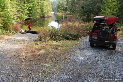
Trip Date: July 27 to 30th, 2010

Goose Lake Map

There is a lot of traffic on Goose Lake these days. As the first leg of the Sayward Forest Canoe Route there is a steady stream of canoes and kayaks heading north towards the portage to Twin Lake. The Northern bay has some decent trout in it too, so that brings anglers in skiffs, powerboats, and Zodiacs. The rotting pilings from the old bridges at the narrows keep the water skiers out, but not the jet skis. And it is only going to see more traffic as the population of Vancouver Island increases.

So why am I broadcasting the location to the world wide web? Because I would like to see this fragile and beautiful environment protected so people can keep on enjoying it for a long time to come. As Michel Gauthier points out in his excellent guide to the Canoe Circuit, "By using the resource, we plant a stake in the ground, a flag that represents our will, our wants, and our desire. The more of us who paddle the circuit, the bigger the flag, the more visible it is to them [the policy makers]. We become a constituency. Our use of the resource forces government officials to take us into consideration when they make decisions affecting the area we have claimed."

The beauty of this place may not be grandiose, but it is impressive in it's subtlety.

The first subtle beauty of the place is it's shallowness.


Notice the paddle swirls in the bottom mud behind Paul in this shot? there is something magical about zipping along over the honey colored silt only a few feet below. Schools of stickleback dart away and even the dusky speckled leaches are beautiful to watch as they nose alone sunken logs in search of hiding places.


The golden color comes from the lake bottom which is a soft blanket of decaying algae, pine pollen, and organic matter. In places you can thrust a paddle 4 feet into it without striking anything solid. All the water from Goose and Mohun lakes (and their tributaries) appears to drain out the small creek that leads to Morton Lake. For most of the year the flow is gentle, so the silt has a chance to settle out.

What this means is that it is a great place for aquatic plants to grow, particularly Yellow Pond Lilly, Watershield, Floating Leaved Pondweed, and Water Lobelia.

Floating-Leaved Pondweed
 Here Paul examines a bed of Verticillate Watermilfoil mixed with Widgeon grass:


The Milfoil, a native species, forms slightly disturbing underwater brain structures:


This is sedgebending territory, with a fair number of reeds and rushes for good measure.


The second subtle beauty of this place is the rock. There are a number of rocky islands and points, as well as rocky escarpments and rock gardens.

Rock Garden with Water Lobilia

I think the main rock here is a basalt. According to this map the Goose Lake area sits squarely atop Karmutsen Volcanic Rocks and Quatsino Limestone. One prospector states that "As we head north from Campbell River towards Sayward, the area is almost entirely underlain by Karmutsen basalts near the top of the section." On Goose Lake these volcanic bones emerge in places to add a solid contrast to the softer textures of water and woods.


All of the good campsites have this stone underfoot, but it is particularily obvious at G5, 6, and 7 and the un-numbered site in the Western Bay:

We appreciated the Shade to Eat Our Lunch In

There is a swirl of stone on this point that looks like it may have been a popped bubble of lava:


One of my favorite places on Goose Lake is Lone Tree Island, which I will devote another post to entirely. This island is a large stone projecting from the water with a beautiful pine with undulating roots that stretch out across the rock:


Lone Tree Island contains the third subtle beauty: Pines. Shore Pines to be exact. Also called Bonsai Pines and Bog Pines. The scientific name is Pinus contorta and it is well adapted to growing on rocks and beside the water.

Sunrise over Pine at Campsite G6
Campsite G6 is on the south side of a picturesque island on which are growing numerous beautiful specimens, not least of which are the ones growing in the campsite itself.


The dense "cloud-like" bunches of branches on these specimens make great shade and the trees are strategically located to provide shelter from the sun most of the day.

That tree on the right has a good example of how the pine trunch and branches twist and turn as they grow. Here is a close up:


The contorted pines continue to grace the landscape when they fall down and loose their bark, revealing their beautiful twisted interiors.


 This combination of shallow water, volcanic rock, and trees with deep character make this a place to experience wabi sabi in abundance. It is an experience worth savoring.

I hope that you will visit Goose Lake and tread lightly when you do. But please do visit, and tell your friends, and tell your political representatives that this unique and beautiful treasure needs to be protected, enhanced, and saved for your children and their children.

The campsites need better toilets and some signs to let people know how fragile the environment is. Tables would prevent the cutting of trees and small wooden docks in places would prevent the deterioration of the shoreline habitat.

A big thanks must be given to the Comox Valley Paddlers who have installed the cedar toilet boxes in some campsites.

Lets hope that Ministry of Tourism, Culture and the Arts which now managers the area will receive funding to maintain and protect this valuable natural resource. This is a premier recreational location in western Canada and deserves careful management.

Saturday, 10 July 2010

Blackwater Lake

Vancouver Island Backroad Mapbook 4th edition - Map 39 G3
Atlas of Canada Link:Blackwater Lake
Latitude and Longitude: 50° 11' 2" N 125° 35' 9" W
Decimal Degrees: 50.184° N 125.586° W
UTM Coordinates: 10U 315386 5562301
Topographic Map Sheet Number: 092K04

Trip Date: July 1st, 2010


Blackwater Lake is a long narrow, somewhat winding, lake with a range of shoreline features including reed and sedge filled bays, rocky points, and an interesting estuary at the south end of the lake where the water from Amor lake flows in via a short creek.

Paul and I  arrived mid-morning after camping for two nights on Mohun Lake. The steep path down to the water was somewhat off-putting but we decided it would be worth it. The little beach where you put the canoes in  was sandy and clean with a view to the southerly stretch of the lake.


We paddled south, the wind for the most part at our backs, and Paul was dive-bombed by a defensive gull who apparently thought he was getting too close to her nest. We stayed to the western shore and when Paul pointed out that I was paddling past a beaver lodge I looked at the lodge and into the water and saw large plumes of mud stirred up below my canoe. We did not, however, ever see the beaver, so I'm not sure where she surfaced.


Along the shoreline of the wide curve of the southern estuary we noticed that small cones had collected in hollows in the silt along with what at first looked like deer droppings. Upon further observation I believe they were actually pieces of the peat-like material that formed a mat higher up on the beach. The pieces of compacted soil had been rounded by wave action and jostling with the cones and together they had uncovered the colourful sand below. Fresh water clams were secured in several of the indentations.


We tentatively ventured onto the delta of the estuary at the end of the lake and gingerly walked around taking photos. The ground was muddy and appeared to have recently been underwater.


 I took multiple shots of the inflow to stitch together later with Photoshop.


The drop in water left some lillies to flower without boyancy.


We paddled back along the eastern shore and eventually spotted two fluffy balls of feathers that turned out to be ambulatory gull chicks with black spots all over their heads. The call of the mother was unlike most gull's I had heard, and the distinctive colouration of the chick's heads made me confident I would be able to identify them at home. It has not proved easy. The chicks were near a cliff face, hinting that they may have been Glaucous-Winged gulls. The raptor-like call also suggested this. In memory the parent's seemed mostly white and smaller with greater wing to body capacity that Herring or California gulls, leading me to wonder if they might have been Bonaparte's Gull, but I think I would have noticed the black head.


Passing the put-in we ventured down stream towards Farewell Lake. On the way we investigated an abandoned canoe.


Abandoned canoe
water line higher
on the inside


The outflow wound around a bit, then presented us with a large log jam. Paul got out to look beyond the jam, but there was another one only a few hundred yards downstream. We decided to head back upstream.


It had threatened rain for most of our paddle, and the wind had been strong at times, but as we made our way back towards the put-in, blue sky took the place of the clouds. Climbing back up to our vehicle we shed sweaters and shirts.


I was able to take some shots for a high dynamic range photos which captured well the quality of this beautiful Sayward Forest lake.

Tuesday, 13 May 2008

Amor Lake

Vancouver Island Mapbook - Map 40 A3
Atlas of Canada Link: Amor Lake
Latitude and Longitude: 50o 10' 0" N - 125o 32' 59" W

Trip Date: May 4th, 2008

The day before our trip it rained. The next morning the sky was grey and wind chilled our hands as we strapped the canoes onto the Tracker. The weather forecast said the sun would come out; there would be some late afternoon wind, but not a drop of rain. The next day would be clear and calm. I read several different reports and said a prayer. Then we headed out.

Just past Courtney the sky lightened and by the time we reached Campbell River the sun was out. We arrived at the lake in the early afternoon, backed our Tracker to the water’s edge and loaded our supplies and gear into the canoes. The put in is a pretty spot where the lake funnels all the water collected from surrounding Mud, Twin, and Surprise Lakes, and several smaller un-named bodies, into the creek that leads to Blackwater Lake, then Farewell Lake, and on down to Amor de Cosmos creek which flows through McCreight Lake before finally exiting into the Johnson Strait.
Several aluminium skiffs bumped gently against logs with powerful looking outboard motors raised and glinting in the sun. In a campsite on the far side of the creek a Great Dane and another large dog barked menacingly at us till their owners shushed them. The two beasts stood erect watching us with the slight tremors you see in animals trained to stay, but itching to give pursuit.


We pushed the canoes into the channel and began paddling away. A robin sat on a log watching us as we made the small adjustments of gear and foot pegs necessary to get comfortable in a boat with a larger load than usual.


Then we were pushing out, past the confines of the protective cove, past three men in a power boat attempting to negotiate a shallow channel that connects behind one of the numerous small islands on the lake. A jovial and somewhat inebriated bowman informed us that there were no fish in the lake, at least as far as he could tell, while the captain in the stern lifted the prop creating that guttural growl props make when taken from their usual environment. We pushed on around the corner, the wind at our backs, gliding along in the joy that rises as you begin to realize you are leaving it all behind while the pines and firs and cedars luff around you like sails, the wavelets lapping against the hull.


As we paddled through the sheltered water behind the island that marks the transition from the south western arm of the lake, to the main body of the lake we could see that it was blowing north to south down the lake, creating a moderate chop. We paused in the shelter of a promontory and then headed into the wind. By sticking close to shore, we avoided the hard work of paddling directly into a wind and soon were nosing our way into a sheltered bay with a sandy beach. We went ashore and explored a pleasant campsite with a kitchen station created from a tree root mass.

It was a nice spot, but we were keen to check out some other sites so we headed north again, then spied the island we suspected contained the Sterling Island Rec Site and headed for it.

We approached from the North, running with the wind, and navigated easily around the small island to a lovely quiet spot on the South eastern shore. There we beached the canoes and had a look around.


I have to confess that the site has a magic about it. Like passengers from the fated Minnow, we knew at once that this was the place we would be spending the night. The campsite itself is located on a relatively flat area in the centre of the island surrounded by trees and salal bushes with an impressive fire pit constructed with some skill from large angular stones. An L-shaped bench on one side of the fire pit is constructed of a weathered cedar log and an equally weathered plank. We immediately hauled our canoes to high ground, set up our tent, and strung a tarp between trees on the north side of the site against the brisk north wind. I was worried that we might regret the choice of the Northern most island directly in the teeth of the gale, so to speak, but behind our tarp we were comfortable enough and the wind certainly kept the bugs away.


We found our container of fire wood (I always like to bring my own when I don’t know how much is available on site) and assembled our
Portable Buck Saw and found a large pine limb that had fallen, we surmised, in the recent heavy spring snow and proceeded to buck it up. I also found one weather worn piece of cedar on the beach which we set aside for the evening fire.

In the interest of keeping the carbon release low I broke out our Little Bug stove and soon had a roaring little fire which quickly mellowed into the sort of flame that begs for hot dogs. It just so happened that we had such culinary delights along and set to the task of roasting them.

Before long the sun was setting and we shook out the coals from the Little Bug stove and mounded the wet pine and weathered cedar so that we could enjoy the crackle (and hiss) of a full blow fire. Nothing, and I say this without hyperbole, creates a more receptive and peaceful mind than the gentle act of fire gazing after a relaxing day of paddling. The silence expanded as the wind died down and the embers dropped into a dry hush, such a soothing experience that language seemed too rude to bring to voice. These shared moments of contemplation are silken raiment’s on a day of rest. We left the dying coals and went to the beach to stare up at the stars. We stood, blinking at the universe before heading back to camp and our bed rolls.


The morning broke cold and calm. Canada Geese surrounded the island and seemed to be engaged in some sort of territorial dispute that required goosy conversation at full volume.

After watching the sun rise I started a fire in the Little Bug Stove and soon had water boiling in the Kelly Kettle. My son took charge of the frying pan and the smell and sizzle of sausages filled the camp. Combined with steaming scrambled eggs and store bought cinnamon buns it made a mouth watering meal. As is often the case in the outdoors, the food was tastier by far than the same meal would have been prepared at home.


After breakfast we dismantled camp, loaded the canoes and headed out. I tried fishing and we cruised the lake, now beautifully calm, admiring the rocky shoreline and thick second growth forest, and enjoyed the sensation of gliding over a sunken world.

We made our way to the Mr. Canoehead Rec Site and found it silent and spacious under a full canopy.


We wandered up the short portage to Surprise Lake, saw fish rising, and headed back to Amor Lake to fetch one of the canoes. We then spent a happy two hours fly fishing, both of us reeling in firm cutthroat trout from the crystal clear water.
http://rrpowell.homestead.com/files/amorlake/slides/Amor-Lake_203.jpg While my son was on the water in the canoe I made my way along the shore casting from the logs and releasing the trout I caught. When it was time to head back I went into the forest thinking it would be shorter than battling the bushes at the lake edge. I immediately surprised a Ruffed Grouse who I had heard drumming earlier. As is the nature of these curious animals, this male did not take flight but simply walked around behind a tree. I walked around the same tree and he walked around another, the erect feathers on the top of his head arching forward and back. When I followed him around his second tree he fanned out his large tail and gave me a shock of beauty I hadn’t had for awhile. “Ok,” I said to him aloud, “If you are going to play the I’m-too-gorgeous-to-eat card, I guess I will have to leave you alone,” and I ventured past, while he sidled casually behind another tree like a gentleman exhibiting a ballroom courtesy.

Back at Amor we pushed off and made our way over more sunken mysteries (lilly pad roots? Waterlogged docks? Is that a train tressel?) and all too soon we were pulling our canoes out of the water surrounded by a new collection of campers. We chatted with some folks who had been coming to Amor Lake for years and wished them luck as they headed onto the water, willow leaf lures flashing from their rods.
Summation: Amor Lake is a moderately sized lake that epitomizes the paddling pleasure of the Sayward Forest area. Multiple small islands and coves provide that, “I wonder what’s around the next bend” feeling and multiple arms (5) allow for many optional destinations. We only explored the southern reaches of the lake, not even half its area, and I think it is reasonable to say that you could spend three happy days on the lake exploring its various coves and islands. We counted 4 obvious campsites not counting the 8 or more sites located beside the boat launch. The map indicates that there are two more campsites on the eastern arm of the lake and I suspect there are others on the two northerly arms as well. Regarding fishing, there were three small power boats and a row boat at the boat ramp when we arrived and in past visits I have observed numerous power boats. The folks we talked to had trolling gear and Vancouverisland.com lists the following resident species: Cutthroat Trout, Dolly Varden Char, Kokanee Salmon, but Amor Lake is not scheduled to be stocked by the Freshwater Fisheries Society in 2008 and does not appear to have been stocked in recent years. So I would not expect good fishing from such a heavily fished body of water that is not stocked.
Recommendations: Wind does seem to be a common complaint made by folks who have paddled the lake as part of the Sayward canoe route and I know that nearby Brewster Lake routinely produces whitecaps on summer days from noon to dusk, so if you are interested in paddling Amor consult your weather forcast and pick a calm day or alternatively plan to paddle during the morning or evening hours. Even during the mid-day bluster if you keep near the shore you will have lots of opportunities to duck behind rocks and logs, and into bays and coves for respite from the wind. None of the sites we looked at had outhouses so bring a shovel or trowel and use common sense when burying your business. The Sterling Island Rec Site has a makeshift toilet (an upturned bucket with the bottom cut out) and while this arrangement is functional, I wonder about its long term viability. If you are of the enlightened and forward thinking tribe who pack out even your pooh, well, I salute you. I don’t think the pressure is currently strong enough to warrant this level of diligence at Amor Lake, but once people find what a treasure this area is, it might need to be practiced before long by all of us. For a handy reference to this subject see: Pooping Perfectly in the Woods By Kevin Callan
For more photos (and larger versions of the ones pictured here) go to: http://rrpowell.homestead.com/files/amorlake/index.html

©Richard R. Powell

Sunday, 20 April 2008

Whymper Lake

Vancouver Island Mapbook - Map 39 G7
Atlas of Canada Link: Whymper Lake
Latitude and Longitude: 50o 2' 59" N - 125o 35' 59" W

Trip Date: April 18, 2008

It’s funny where you end up sometimes. I headed first to Snakehead Lake but found the lake whipped up by a strong wind from the North, so I headed to Camp Lake, but loggers and equipment were everywhere and the crew boss was not happy with me “bombing along” his road, so I left and headed back to the Sayward Forest again. My son and I paddled there the week before and on our way past Whymper Lake I said to him, “that looks nice.” So I went to Whymper.


I think it is fairly safe to say that almost no one goes to Whymper Lake on purpose. Paddlers on the Sayward Forest Canoe Route must pass through the lake, but it would take a determined small water paddler like me to find this little jewel with so many larger gems near by. There is no boat launch ramp, no trail to the lake edge, only the portage trail which is all but unseen from the roadside.

I decided to see if there was a way to enter the creek above the lake so that I could paddle down the bushy corridor leading to the lake. I found an overgrown road leading to a crumbling old bridge but the alders were completely covering the road and I was only able to pull the Tracker off the main road enough to unload. A short bushwhack to the creek edge and I was away.
Whymper Lake
The lake is essentially a swelling of the creek and I could always feel the tug of the current on the hull, even in the largest flat part of the lake. The wind was gusty, but such a small body of water does not allow any kind of real chop to develop and I found that if I cruised near the shore, the wind hardly bothered me.

I paddled around for about two hours looking at the new bulrush leaves poking out of the mud, watching migrating water fowl pass overhead, and examining a profuse amount of what I later identified as Sweet Gale, or Myrica gale. The waxy catkins of this aromatic wetland shrub appear before the leaves and these catkins were just cracking open in the spring sunshine. The golden hue of them lit the grey boarders of the lake with a gentle glow.

Sweet Gale is reported to be on the badge of the Campbell clan, and having found this shrub in great abundance this close to Campbell River seemed apropos.


According to Mrs. M Grieve, “The leaves (of Sweet Gale) are often dried to perfume linen, etc., their odour being very fragrant, but the taste bitter and astringent. The branches have been used as a substitute for hops in Yorkshire and put into a beer called there 'Gale Beer.' It is extremely good to allay thirst. The catkins, or cones, boiled in water, give a scum beeswax, which is utilized to make candles. The bark is used to tan calfskins; if gathered in autumn, it will dye wool a good yellow colour and is used for this purpose both in Sweden and Wales. The Swedes use it in strong decoction to kill insects, vermin and to cure the itch. The dried berries are put into broth and used as spice. In China, the leaves are infused like tea, and used as a stomachic and cordial.”Gotta love a shrub that can do all that.

I look forward to visiting this area again after the plants leave out. I noticed Caddisfly larvae moving on the muddy bottom and would expect this to be a productive section of stream for the fly angler even though my dry fly arrangement did not produce any takers and I had left my wet fly reel in the vehicle.

If you decide to seek out this lake be aware that the shoreline is composed of fragile bog plants. I recommend doing as I did and enter the lake via the stream where the creek edge is less vulnerable to human impact.

For more photos go to: http://www.flickr.com/photos/stillinthestream/
and click on the 100 Lake Project link.

©Richard R. Powell

Tuesday, 26 February 2008

Roberts Lake

Vancouver Island Backroad Mapbook - Map 40 A2

Atlas of Canada Link: Roberts Lake

Google Earth: Type in “Roberts Lake BC” and it will take you right to the lake. There is a Google Earth user photo already on the lake.

Latitude: 50°12'58.15"N
Longitude: 125°32'40.69"W

Trip Date: February 24, 2008

I leave the house at 9:30, the sun is stark in a cloudless winter sky. From the parkway above Malaspina University-College I glimpse open ocean all the way to a fogbank against the mainland. Those poor citizens of Vancouver are shrouded in mist. No sun for them, at least not for several hours. It always feels good to be heading out paddling in sunshine, but somehow doubly good when it is a fortuitous event. The random fate of weather, allowing me to seize the day, while others ponder the ceiling of grey.
Part of the pleasure is knowing that no one is thinking about me, I am a self contained expedition, master of my own destiny. Not expected back till after dark, the whole day spread before me. Solo trips are luxurious, truly incomparably deluxe. A Westfalia van passes me, a couple in their thirties with outdoor jackets and hats. I imagine they are heading for the great outdoors too and speculate on their destination. The woman sees me watching them and I smile dumbly at them, a goof with a canoe in February.

My destination is Hell Diver Lake. Last night I looked up elevations on several lakes. Hell Diver is at 132 meters. Nanaimo’s own Westwood Lake is higher than that at 164 meters with no ice, so I think the water will be open at Hell Diver, but when I get there an hour and a half later, it is frozen over.


Small Lake Below Hell Diver

A small lake below Hell Diver, but just as frozen over...

Hell Diver is a small shallow lake south of Campbell River, so I can see why it might be frozen. I head further North to Quinsam Lake, which is a large deeper lake so perhaps not frozen. But it is at a higher elevation. It’s a gamble, but I head for it anyway. On the Gilson Main I run into snow. In the dip by Gilson Lake I feel the Tracker fishtail through the ruts of previous vehicles. On the hill between Gilson and Quinsam I reconsider. I can see Gilson Lake frozen below me on the right. The ruts in the snow are deep, throwing me around, wheels spin, the load behind the back seat shifts back and forth, paddles knocking together. I look for a turn around. I’ve wasted hours finding Hell Diver and now trying to reach Quinsam. I wonder where the Westfalia folks are and hope they are having better luck. I turn the Tracker around and head back down out of the snow, trying to think where else I can try.

On the Gilson Main On Gilson Main above Gilson Lake

Larry Bowers of West Coast Canoe Company had given me a tip that Roberts Lake was a nice paddle, close to the highway north of Campbell River. I know that another lake near Roberts, Twin Lake, is at 247 meters but I had not looked up Roberts, so I’m left to speculate. I drive into Campbell River and stop to eat a Big Mac and ponder my options. It is 2:00, the sun is past its zenith, but Roberts is a deep lake, I reason, and my curiosity gets the better of me.

On the way past Menzies Bay I catch up to a transport truck, he slows down slightly as we pass a section of planted alders, the sunlight streaming through them across the road. Flash, flash, flash all down the long straight stretch of highway. When we are past the alders the truck speeds up again, the grey trunks and tawny sunshine lingering in my after image, such beauty from such dormant elements.

I watch the snow grow deeper in the ditches all the way up the long hill past the Menzies Lookout, past the turn off to Twin Lake. I am very doubtful that Roberts will be clear of ice. But then the road crests and begins dropping and shortly I see the Roberts Lake Resort sign, and glimpse the lake through the trees. I stop at the rest stop to get my bearings and see that there is a road running along below the highway, right beside the lake. I hop back in the Tracker and find the turn off almost immediately near the northwest corner of the lake.

Roberts Lake Looking North

The water is as still as I have ever seen a lake be. There is literally not the slightest breeze. In the bay there is a small amount of floating clear ice but I take down the canoe and head out onto the water craning my neck to see the snow covered mountains to the east and north. I paddle out across the lake towards the farthest north-eastern corner where a creek drains Cecil Lake. I want to see if it is possible to paddle or portage up the creek to Cecil Lake. Along the northern shore I cruise carefully looking at large rocks just under the surface. Some have black tops, with dead algae below. I deduce that they stand above water part of the year, the algae line indicating the usual water level. The lake is full but the water is clear and still, I can see the rocky bottom as it curves steeply over a sharp underwater drop into darkness.

In the bay near the creek a wooden structure stands on a point, bones of a summer camp. Buoys float without moving in the lake. I imagine that in the summer boats, power boats even, dot this shore, oil spilling across the pristine surface. I listen for voices, laughter, splashing children, but it is quiet as velvet, only the small whisper of the creek running out across gravel.

The sound of the hull contacting with the gravel rouses me and I clamber out to stretch my legs. I spend some time examining stones along the shore. The gravel is uniform in size but sharp edged. This is a young place, the stones have not been smoothed overly, they are recently cracked apart, but the uniformity is pleasing.


Back in the canoe I paddle down the eastern shore, past another long dock and along a small island. Then, in the distance a large boulder on the shore catches my eye and I paddle towards it. Someone has constructed a very precarious looking diving board on top of it. I look into the water below it and can not see a bottom. I look at the shore to discern a camp or building. There is no obvious clearing.

I paddle around the point and towards the second inflow. There is another point, then a sandy bay, then a cluster of shrubs with red branches. As I paddle closer I see that the branches are a variety of shades from orange to pink to red. These bushes are worth the whole trip. I rest my paddle and stare at them, the canoe gliding silently, the sun angling towards the horizon.


Roberts Lake on a sunny February day consumes my visual field. Dark grey almost black rocks roughly cut but slightly smoothed, bleached logs, rippled sand, dormant vegetation armoured in color, the sun drawing out all pigment, exposing subtle variations in texture and pattern.


My muscles warm as I paddle back across the lake to the vehicle, the sun winking out behind the hill. Like an unexpected jewel on a grey stony shore, this unexpected winter beauty has been mine all day, and if feels as if no one else knows about it. A gem sitting in plain view along highway 19. It would be a nice place to set up a Westfalia.

More pictures of Robert Lake are located on my Flickr pages at:
http://www.flickr.com/photos/stillinthestream

Text and photos © Richard R. Powell