 |
| New Canoe Cart |
The trail to the water's edge was completely grown over. Small firs had grown larger and one small tree had fallen across the trail. But once I negotiated my way through the bracken fern, raspberry, and salal, and climbed over the fallen tree, I found the shoreline and the old log where I used to put in when I first started visiting this lake in 2007.
 |
| These two shots are from slightly different angles, but you can see common markers in the snags and log. The water is higher by more than a foot and the young fir on the left was not even visible in 2007. |
It took me a few minutes to collapse my cart and stow it in my canoe, and I confess I paused a moment to take in the pond in all it's summer glory. I don't think I have been on the pond at this time of year before and the verdant lushness was impressive.
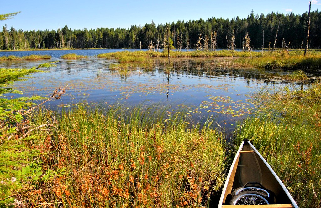
After the dusty walk and effort to make my way through the underbrush, I was happy to get out on the pond where a nice breeze cooled me down, especially when I was across the lake and into the shade on the far side. I made the following video after exploring the shoreline for about an hour.
Here are a few of my favorite photos from this trip. For more, see my Trail Pond set on Flickr.


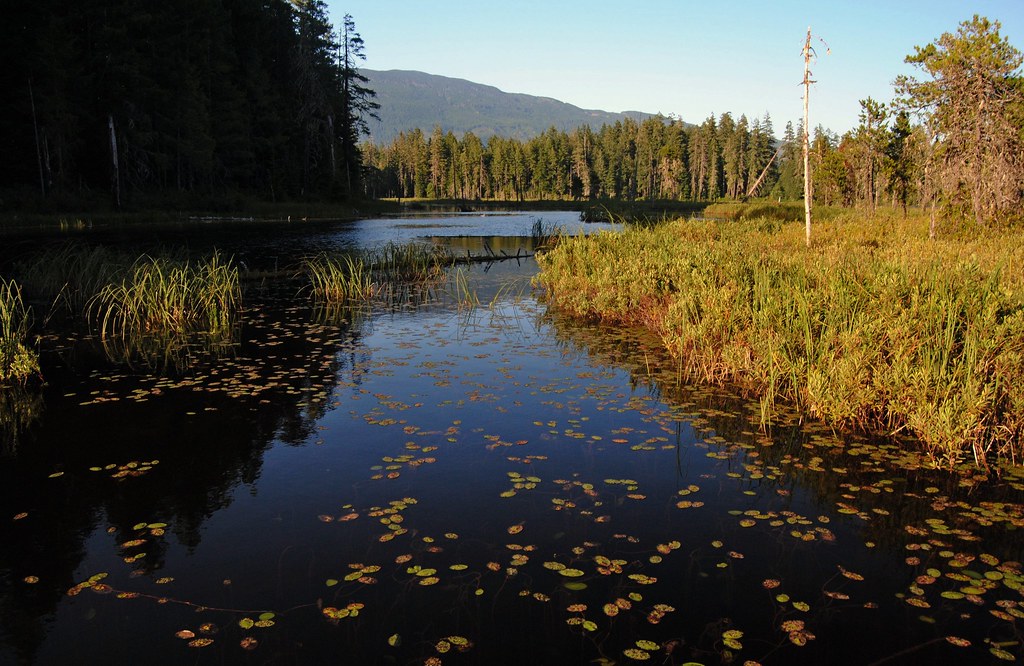
I was delighted to find I could paddle into areas of the wetland that had previously been blocked by sticks. Here is an image from 2007:

In 2013 I was able to paddle past this point right down to where the beavers had been busy.
 |
| Looking towards the beaver dam from the place I used to have to turn around. |
The dam itself was impressive. I estimated a 4 or 5 foot drop on the downstream side.
 | |
| A Healthy Beaver Dam |
Looking downstream from the dam revealed a lush outflow, demonstrating the value of beavers in maintaining and improving wetlands.
 |
| Looking Downstream from the Beaver Dam |

A Note about logging and pretension.
Readers of this blog have sometimes criticized me for being pretentious when I express my sadness over the ugliness logging creates beside treasures like Trail Pond. While I do mourn the loss of beauty often in my writing, I am careful to balance it with an appreciation of logging as a mainstay of the BC economy and I do value being able to use logging company and forestry roads to access these locations.
I have commented lately to family and friends that cuts are much less ugly than in years past. This is due in part to the practice of creating smaller cuts, spread out over the whole island, rather than large clear cuts as was the practice before. For example, only one hillside was logged here at Trail Pond and it is actually not ugly at all. The presence of a gate, which appears to be locked indefinitely, seems also to have kept the yahoos out. I didn't see any beer cans or other litter. No torn up ground, burned logs, discarded sleeping bags, or other evidence of human impact. It was, I have to say, a welcomed surprise. While visiting this place in the last few years I have met bicyclists, hikers, and one man riding an impressive and beautiful horse. It seems to me that all such uses place a very light load on the road and land; and the gate's strategic location has also kept ATVs out, which adds to the quiet and tranquility of the location. Now before all the ATVers start up, I'm not opposed to the responsible use of quads but have seen some ugly scars created by quads on hillsides and in forests. Worse that any skidder now in use!
I know I am uncomfortably sentimental for many when I write and talk about these beautiful places, but I am unapologetic. Beautiful natural settings and tranquility seem to be diminishing in our world. I see houses being built and "no trespassing" signs going up, where previously the wider public enjoyed the views and scenery. I love these places and want to see them respected and preserved so that future generations can have the same experiences we who now visit them have. I hope trail pond continues to be a haven for turtles, beavers, and the odd ducks like me.


 I made a wrong turn past Nixon Creek and went left (South) up the Caycuse Main. It was a fortuitous error as the valley contains Nixon Creek and was beautiful. Large Broad Leaf Maple trees are covered in moss and I stopped the vehicle near a bend in the creek to examine a large heap of logs recently deposited at a curve in the channel. Sand and stones were mixed in with the wood detritus so the creek must have really been thundering when it deposited these logs. Clearly this valley gets a lot of rain and subsequent run off.


 The map (9 A1) indicates that access to Kissinger Lake is off the Nitinat Main and I inadvertently passed the Nitinat Main and turned left instead at the North Shore Road intersection. The Mapbook has a dashed line where this road continues away from Cowichan Lake, so I didn't immediately realize I was on the wrong road. I guess the old the road has been re-activated.


