Atlas of Canada Link: Jim Mitchell Lake
Latitude/Longitude
Degrees, Minutes, Seconds: 49° 31' 5" N 125° 36' 1" W
Decimal Degrees: 49.518° N 125.601° W UTM
Coordinates: 10U 311780 5488306
Topographic Map Sheet Number: 092F12
Trip Date: July 29, 2011

The Road up to Jim Mitchell Lake is actually pretty good -- but steep, really steep. Virtually no pot holes or washouts and several stretches of new gravel and fill. Someone is doing a good job of keeping this road in shape.
Near the top of the road, on a level spot, sits the parking lot for the steep hike in to Bedwell Lake. We pass a large silver Chrysler sitting in the parking lot and look at each other in disbelief. We turned the hubs in on the Tracker 10 minutes ago because of deep loose gravel on a steep hill.
We continue to the lake. It isn't much to look at from the put in. A smallish body of water under the shoulder of nearby Mount Myra, the summit hidden behind the nearness of the slope. There is snow within sight on some of the surrounding hilltops. A wind blows at us and a few drops of rain hit our faces. We sigh and unload the canoes in silence, having driven up that steep road when we could have had a perfectly nice paddle at the bottom of the road in Buttle Lake.
 |
| The Put-in at Jim Mitchell Lake |

We turn and head towards the western end of the lake.

Dark forest gives way to steep slopes of fractured stone.


As we near the first curve in the shoreline the colonization efforts of the flora is impressive.
Both the forest and the water have a feeling of great depth.


We paddle around the corner to a part of the lake that is hidden from the parking lot view and discover another waterfall, and the amazing ability of trees to grow in very rocky conditions.

At the far end of the lake we find the spot where Thelwood creek flows in from Thelwood Lake.

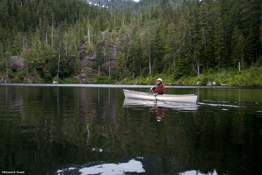
Paul practices his eddy turns in the current.

Then we sit and listen to the whiteness of the water, the silence of the sky, and the gentle lap of waves against stone.
Back at the put-in the Tracker seems small on the exposed road down to the water's edge and the snow-chilled air reminds us of how quickly the elements can turn on you in the mountains.

James Scott Mitchell was described as a "six-foot youngster of quiet habits and a good bushman" who left the main camp of the British Columbia Topographical Survey for a camp near a lake known then as Crystal Lake. The main camp was situated where Price Creek joins Thelwood Creek, in the wide delta at the head of Buttle Lake. Mitchell made his way to "first camp," slept the night, and headed on for "second camp" in the high country beyond. He never arrived. No trail existed beyond first camp, so he was following blazes. He had packed supplies in 11 times already so knew the way well. At a place known as the "upper ford" the 17 year old Jim set down his 50 lb pack and surveyed the creek to find a way across. How he received a concussion and died, is not known, but most likely he fell on the slippery rocks. The creek washed his body downstream where it was found lodged on a sand bar.
in 1947, 10 years after the accident, Crystal Lake was re-named Jim Mitchell Lake.


That is one simply beautiful lake.
ReplyDeleteYour photos are top shelf, wonderful.
A question, does this lake hold trout?
BT,
ReplyDeleteThanks. Yes, we saw at least one trout rise on the lake. It seems to be a deep lake, too, so at this elevation, I'm guessing there could be some sizable fish down there!
We were fishing there on August 25 and caught 4 nice cutthroats and released about 4 for another day. Just a beautiful spot.
ReplyDeleteThank you for the info and photos in this posting! . Jim Mitchell was my children's Great Uncle.
ReplyDeleteFour Wheel Drive isn't needed to reach the lake. I did it very easily in 2wd with my Mazda MPV.
ReplyDeleteThat lake is LOADED with Cutthroat & Rainbow trout. I cannot wait for the lake to thaw, and turn over, so I can get out on it with my new Pontoon.
I was fishing there Aug. (2012) long weekend and there's many smallish trout about 10" long. They liked flies and had white flesh whereas Buttle Lk trout had pink flesh, both were equilly tasty. I'm impressed that you drove there with only 2WD! I wonder if you can hike up to Thelwood Lake along it's creek?
ReplyDeleteGreat to have an update on the fishing. Being a high lake, it probably stays productive all summer, which is a bonus. Interesting note re the flesh colour. I have noticed this at other locations, and wasn't sure if it was the type of fish (rainbow vs cutthroat) or the diet.
ReplyDeleteI wondered about Thelwood Lake myself, and since it looks so close on the map it might be worth a try. The problem might be going ashore. The pictures of Paul near and playing in the outflow show that it is deep and rocky near where the creek comes in. I think maybe it would be possible but my memory is a bit dodgy.I definitely plan to return and will take a closer look when I do.
Lastly, with regard to 2W drive I suspect it depends on when you go and how recently the road was maintained. The day we were there someone had dumped a large amount of gravel on a steep section and we actually bogged down in it. I was going pretty slow, though, with the canoes on top. With a good run, I probably would have made it thru in 2wd, but it really is pretty steep in places, so we would've been bouncing around quite a bit. For seasoned back-roaders, this is probably not an issue. For urbanites with cars/crossovers/etc. a little more challenging.
Thank you so much for this post! Jim Mitchell was my grandfather's older brother. We had always wanted to go to the lake, but thought it was unreachable. Thanks to your post and an Island guidebook, we realized how easily we could do it in a day trip from Courtenay. My husband and dad and I went up at the end of July and it was a lovely canoe ride around the lake. We think we're the first Mitchells who've made it to the lake after Jim Mitchell.
ReplyDeleteThank you for helping us find out about it. I've also just written about it and posted my photos on my food blog, if you'd like to see: http://www.dollopofcream.com/2012/08/finding-jim-mitchell-lake.html.
Hey Stephanie,
ReplyDeleteThanks for the comment and the link to your great post on Jim Mitchell Lake. I was touched by the warm poignancy of your story.
Great blog you have there too, but the way.
Richard
Mitchell lake is very beautiful
ReplyDelete